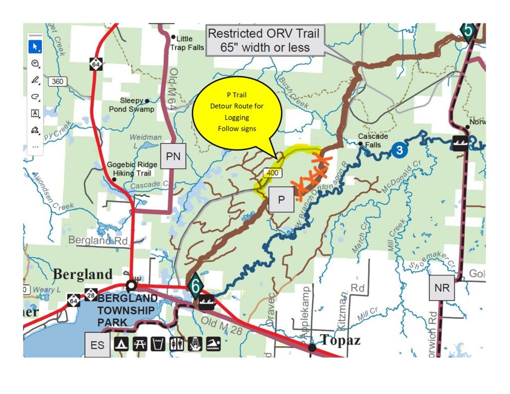
Active logging is beginning on the P trail. Please follow the detour signs around the logging area. This detour will be in place all summer and may be extended into the fall. Please be careful and watch out for logging trucks.
THANK-YOU MI-TRALE
Active logging is beginning on the P trail. Please follow the detour signs around the logging area. This detour will be in place all summer and may be extended into the fall. Please be careful and watch out for logging trucks.
THANK-YOU MI-TRALE
The 2026 MI-TRALE Trail Maps are now available. These can be purchased on our website at https://mi-trale.org/atv-orv/maps/ or at any retailer listed at the bottom of the same page. A huge THANK YOU to our advertisers, which are also listed on the same web page. Please stop by and support them whenever you are in the area. Enjoy the upcoming riding season and ride safe.
MI-TRALE Board of Directors

(list of map locations to be available soon)
“Riding season for the summer of 2026 is just around the corner. Please consider joining the many dedicated folk as a MI-TRALE member. Many of you already have. Thank you. We are busy getting the trails ready for you to enjoy. Let us know if you would like to help. If you have any questions, please visit the MI-TRALE website at https://www.mi-trale.org .”
Due to the Stannard Township Meeting room being used for elections this year, there have been 3 meeting dates that have been moved to a later date.
May 5th to May 11th
August 3rd to August 10th
November 2nd to November 9th
Please mark your calendar’s with this important club update! THANK-YOU
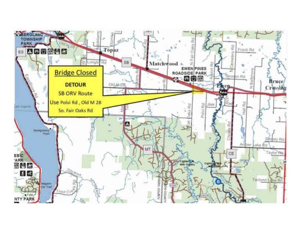
A 1.5 mile detour is now in effect due to bridge damage resulting in unsafe riding conditions. The detour is expected to be in place until April 28th. Please obey all road rules while using the detour. The speed limit is 25 mph on the detour.
Our thanks to Eli Lipske of the DNR Lake Gogebic Trails Unit for helping MI-TRALE manage the signage. Also, a thank you to Linda, Mike, and Dave for their time and support for making this happen.
Thanks,
Donald Helsel
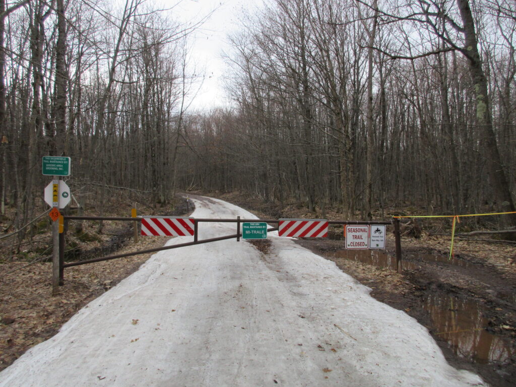
Annual Closures of the Pioneer (P) Trail from Bergland to Victoria and 2 1/2 miles of the LL Route in Paulding. The Ottawa National Forest provided ORV land use permit to operate the Pioneer (P) Trail and the LL Route in Paulding. A condition of the use is that there is to be no wheeled vehicles from March 15th thru May 14th. This is to minimize resource damage during the spring thaw. MI-TRALE has spent over $60,000/year on the Pioneer and over $25,000 on the LL Route to ensure they are safe for the riders. We ask that you support MI-TRALE and stay off the Pioneer and the Paulding section of the LL until May 15th.
 DNR News 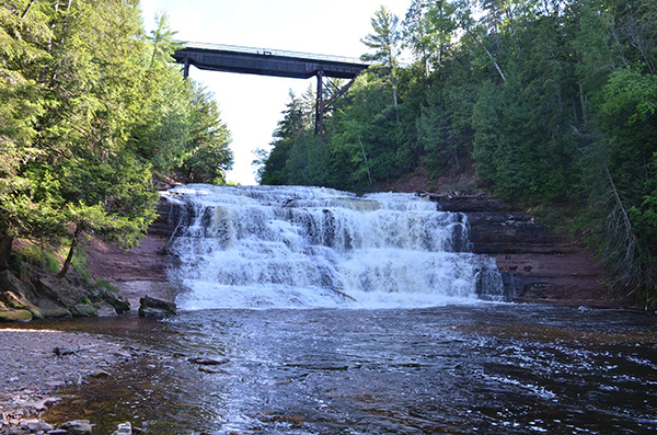 April 17, 2026 Contact: Dan Dowdy (Agate Falls Scenic Site), 906-353-6558 or Carly Graff (ORV reroute), 906-250-5818Agate Falls Scenic Site in western UP closed through fall Repairs and improvements to trestle bridge also require reroute of ORV trail Agate Falls Scenic Site, a popular western Upper Peninsula attraction managed by the Michigan Department of Natural Resources Parks and Recreation Division, is temporarily closed through late fall for essential repairs and improvements to the site’s trestle bridge.This closure, which is slated for completion Nov. 1, 2026, also includes rerouting an off-road vehicle trail that runs through the property off state Highway M-28 in Ontonagon County. Agate Falls Scenic Site is known for its picturesque views and activities including fishing, hiking and ORV riding.“With the work taking place directly above the pathway and overlook, the site is closed to ensure public safety,” said Dan Dowdy, unit supervisor with the DNR Parks and Recreation Division.The DNR is using a Federal Highway Administration Recreational Trails Program grant to pay for the site’s repairs and improvements, which are expected to cost $1.6 million. This program provides funds to states to develop and maintain recreational trails and trail-related facilities for both nonmotorized and motorized recreational trail uses. ORV reroute below 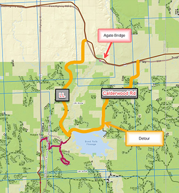 Along with closing the scenic site, the DNR also has rerouted a 4.6-mile section of ORV SB Route. Riders will need to travel on a detour totaling 18.6 miles until the scenic site reopens in November, weather depending.The reroute begins at Mile W, then continues to Calderwood Road, which becomes Bond Falls Road, until it reaches “LL” on the trail. Riders can view this reroute in more detail by visiting the DNR’s interactive ORV trail and route map.“This reroute is a local ‘club route’ and is known as the CW,” said Carly Graff, western Upper Peninsula trails specialist for the DNR Parks and Recreation Division.About Agate Falls Scenic SiteConsidered one of Michigan’s most picturesque waterfalls, Agate Falls is located along the middle branch of the Ontonagon River. A half-mile trail at the scenic site provides access to an observation platform with views of the top of the falls. The trail offers views of overhead railroad trestles and passes through a tunnel under M-28.When the scenic site is open, parking, vault toilets, an adjacent paved trail and a picnic area are available at the adjacent Michigan Department of Transportation roadside park, which is generally open early May through late October.The falls are created as the river finds its way over an extended shelf of terraced sandstone. The resulting waterfall is a broad band of interlacing cascades and small falls nearly 40 feet high. When the site is open, visitors can reach the observation platform via an accessible foot trail.Learn more about this scenic site – and find other nearby U.P. attractions managed by the DNR – by using the DNR’s Recreation Search at Michigan.gov/RecSearch.For more information about ORV riding in the U.P. and throughout the state – Michigan has more than 4,000 miles of state-designated ORV trails, scramble areas, (eligible) county, state forest and national forest roads – visit Michigan.gov/ORVInfo. You’ll find license and trail permit information, an interactive ORV trail and route map, and more.Before visiting any DNR-managed location, it’s always a good idea to check the latest closures due to weather-related events and planned improvement projects and repairs occurring at DNR facilities around the state. Any revised construction timelines will also announced on the DNR’s closures webpage at Michigan.gov/DRNClosures.Note to editors: Accompanying photos are available below for download. Caption information follows.Agate Falls: Agate Falls Scenic Site, a popular western Upper Peninsula attraction managed by the Michigan Department of Natural Resources Parks and Recreation Division, is temporarily closed through late fall for essential repairs and improvements to the site’s trestle bridge.ORV reroute: Along with closing the scenic site, the Michigan Department of Natural Resources also has rerouted a 4.6-mile section of ORV SB Route. Riders will need to travel on a detour totaling 18.6 miles until the scenic site reopens in November, weather depending.The Michigan Department of Natural Resources is committed to the conservation, protection, management, use and enjoyment of the state’s natural and cultural resources for current and future generations. For more information, go to Michigan.gov/DNR. |
MI-TRALE held their Annual Meeting and Board Elections on Monday, January 12th, 2026. They were held in the Stannard Township Hall, 14927 State HWY M-28 East, Bruce Crossing, MI, 49912 beginning at 7:00pm Eastern.
Our current Vice President, Jon Fourez was re-elected to his same position as was our Treasurer Dave Bishop. One of the three Directorships, that were open for election, was currently held by Chris Palmer. He was re-elected to that position. So he, Vice President Fourez and Treasurer Bishop will continue in their respective roles for the coming two years. They have all done excellent work for MI-TRALE in their past years of service and we are looking forward to working with them through their next term.
The other two Director seats were filled by new persons to the Board. Chris Kooyers, originally from Holland, Michigan who now lives in Sidnaw with his wife Cindi and Adam Gingery who is the CFO at Trierweiler Construction in Marshfield, Wisconsin, where he lives with his wife and two children. He also has a second home in Land O’ Lakes, Wisconsin with quick access to all of MI-TRALEs trails. Their terms of office are also for the next two years. MI-TRALE enthusiastically welcomes them as new Directors to the Board. Both of their work experiences will be a valuable asset to MI-TRALE and we look forward to working with them as members of our Board.
The BN culvert project has been completed and the trail has been reopened. Thank-You MIDNR for keeping our trails safe and in great riding condition by identifying these projects before they are a disaster. Remember-RIDE RIGHT-RIDE SAFE!
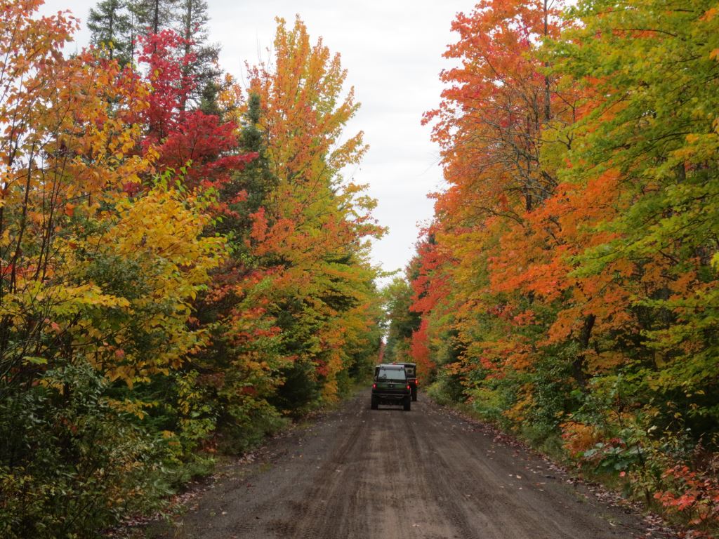
Sep. 17, 2025 –When it comes to spectacular fall colors, the Upper Peninsula stands unmatched. This year, USA TODAY readers confirmed it once again, voting Michigan’s premier autumn showcase the nation’s No. 1 choice in the 10Best Destinations for Fall Colors Awards Follow the links for the rest of the story!